

Signals: S4 Valuation & Appraisal Gap · S1 Insurance Repricing · S6 Chronic Climate Stress
Peer-reviewed measurement puts subsidence in the worst parts of Mexico City at 50 centimeters per year, close to twenty inches, and finds the rate “mostly constant since at least 1950” and “almost fully irreversible.”
Properties in those districts keep changing hands at prices set by comparable sales that assume the land is stable.
That is not a failure of diligence. It is what an appraisal is built to do, and it is the single most under-examined gap in real estate valuation.
The Moment
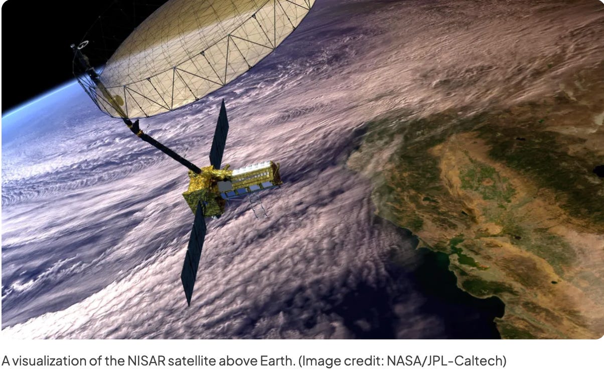
From orbit, NASA’s NISAR radar can watch the city drop.
Between October 25, 2025 and January 17, 2026, the mission measured parts of the metropolitan area “subsiding by more than half an inch, more than 2 centimeters, per month,” with Benito Juarez International Airport sitting near the center of the mapped area. By the 1990s and 2000s, NASA notes, parts of the city were sinking at around fourteen inches per year.
This is not a slow-motion abstraction, and it is not a forecast. It is a measured rate under a functioning international airport in one of the largest cities on the planet, taken this year.
The physical mechanism is well established. The city sits on the bed of an ancient lake. Decades of extraction have drawn the aquifer down faster than it recharges, and the clay beneath compacts as the water leaves, so the ground subsides unevenly, building by building.
The peer-reviewed work that established the rate did so by integrating 115 years of leveling with 24 years of satellite radar and 14 years of GPS. Its conclusions are noteworthy. The rates have been broadly constant for seventy years. The compaction is almost fully irreversible, so recovering the aquifer would not raise the ground. And the authors forecast roughly 150 years of continued compaction, with up to 30 meters of additional subsidence still to come.
A hazard that is measured, constant, irreversible, and forecast a century and a half forward is about as legible as physical risk ever gets. And it is still not in the comps.
The Story
To understand why, look at what an appraisal actually is.
A comparable-sales appraisal records what other people recently paid. By construction, it is a backward-looking instrument. That is not a flaw. It is the entire methodology, and it works extremely well for any risk that is already reflected in transaction prices.
It fails on exactly one class of risk, that of a hazard that is knowable in advance, changes slowly, and has not yet produced a transaction that prices it. Chronic subsidence is the purest example available.
Compare it with a flood zone. A FEMA designation is a published, parcel-level, forward-looking statement about hazard, and because it is published, and because lenders require it, it reaches the price. The information does the work only because a rule forces it into the room.
Subsidence has the measurement, not the rule. There is no designation, no mandatory disclosure at the point of sale, and no lending requirement to obtain a reading. So the data exists and never meets the transaction.
Insurance quietly widens the same gap. Earth movement, which standard property forms cover as earth sinking, rising, and shifting, is excluded from most US property policies, including all-risk forms. The federal flood policy excludes “land subsidence” by name. The cost of foundation and utility damage therefore migrates from the carrier back to the owner, which means it never appears in a claims history either, and a claims history is one of the few forward-looking inputs an underwriter actually reads.
And there is a second-order effect, one that’s almost too obvious to be mentioned. Ground that has subsided sits lower than it did, and lower ground collects water. A district can face damage from too little water in the aquifer and too much water at the surface, from the same cause.
How large is the price effect? Nobody has published a defensible answer for Mexico City. The physical measurement is excellent, and the valuation research is thin to absent, which is itself a finding. When someone does measure it, the number will land in a market that has been transacting without it for decades.
The policy machinery has started moving on the cause, though not on the pricing. Mexico published a new General Water Law in the Diario Oficial de la Federación on December 11, 2025, which took effect the following day, reorienting the system toward basin-level governance. It both creates the new law and reforms the 1992 National Waters Law, which remains in force. Several provisions widely attributed to the new law, including the national water registry, sit in the reformed older statute instead. It addresses extraction. It does nothing to help a buyer price the effect.
Structural Forces
Three forces hold the gap open, and a fourth is starting to close it.
One: comps are backward-looking by design. When the hazard is chronic rather than a dated event, the comparable set encodes a world that no longer exists, and value lags physical reality until a transaction finally reprices it. No mechanism inside the appraisal can anticipate it.
Two: chronic hazards have no trigger date. Unlike a flood or a fire, there is no single day the loss occurred, so there is no claim, no headline, and no moment that forces a number down. Damage accrues to foundations and systems continuously, beneath the appraisal’s line of sight and beneath the policy’s.
Three: the supply side has no answer to sell. This month’s briefs have followed builders and suppliers certifying a shingle, engineering a frame, or shaping a tower against the wind. Every one of those answers works because the hazard produces a testable performance standard a manufacturer can certify to. Subsidence does not. No rating exists for a foundation that outlasts a sinking aquifer, and no carrier offers a discount for one.
That asymmetry is itself an investment signal. Where a hazard has a certifiable product, the cost of managing it is shared with a manufacturer and priced through a warranty. Where it does not, the burden falls on the owner and the lender.
Fourth, and this is the one that changes: the measurement has arrived. The United States now has a peer-reviewed baseline. Researchers using space geodetic data from 2015 to 2021 found that in all 28 of the most populous US cities, at least 20% of the urban area is sinking, affecting roughly 34 million people, with more than 29,000 buildings in high- or very high-damage-risk zones. Houston is the fastest, with 42% of its land area subsiding faster than five millimeters per year.
That is the same hazard, in the same asset classes, under the same appraisal methodology.
The Next Chapter
The gap will close. The only question is how violently, and the sequence is predictable because every priced hazard has run it.
First a hazard becomes measurable.
Then it becomes disclosed.
Then it becomes priced.
Flooding took decades to move through that sequence and needed a federal program to force the middle step. Wildfire is somewhere in the middle of it now, pushed along by carriers rather than regulators. Subsidence has just completed step one.
So watch the disclosure requirement, not the satellite. The technology to measure this at parcel level on a schedule already exists, and NISAR’s public data release began in July 2026. What is missing is the rule that puts the reading in front of a buyer before closing, or in front of a credit committee before funding.
When that rule arrives, it will not arrive gently, because there is no partial version. The day a lender begins requiring a subsidence reading is the day every asset in a fast-subsiding district reprices at once, and the repricing will reflect a hazard that has been accumulating, measurably, for seventy years.
The transferable pattern runs from Mexico City to Houston’s western suburbs, to Jakarta and Dhaka, to the US coasts. Any market where the ground or water is moving faster than the comp set is carrying value that hasn’t been marked.
So the question for investors, lenders, and appraisers is this. If the ground itself is moving and your comparable set cannot see it, are you buying an asset or a liability the market has not yet dated?
The number on the appraisal reflects the past. The risk is a fact about the future. The investor who prices the second before the market reprices the first is the one not holding the gap when it closes.
And the discipline generalizes past subsidence, which is why it closes four weeks spent on what buildings can be made to survive. Measure the thing before you are forced to price it, whether that thing is a shingle’s impact rating or a foundation’s sinking rate. Building science asks what survives.
The harder question, and the one this publication turns to next, is who decides what that survival is worth and how quickly the money works it out.
As always, KNOW YOUR SIGNALS and BE CLIMATE READY!
Jamie
Go Deeper
This is a Story & Future Thinking brief, so there is no companion workbook. The blank master CRDF Signal Tracker™ and Deal Stress Test™ are free and available at climatereadyre.com/tools.
Related briefs
Same signal (S4 Valuation & Appraisal Gap):
Brief 34 · Real Estate Climate Risk: Acute vs. Chronic Threats
Brief 5 · Sun Belt Multifamily Insurance and IRR: Climate Risk Behind a 207% Rise
Next in sequence:
coming soon
Sources
Every figure above, with the date the data covers, the date it was published, and the date I verified it.
Mexico City subsidence rate — rates reach 50 centimeters per year, have been mostly constant since at least 1950, and the compaction is almost fully irreversible; the study integrates 115 years of leveling with 24 years of satellite radar and 14 years of GPS, and forecasts roughly 150 years of continued compaction with up to 30 meters of additional subsidence.
Chaussard, Havazli, Fattahi, Cabral-Cano and Solano-Rojas, Over a Century of Sinking in Mexico City, Journal of Geophysical Research: Solid Earth · Data as of 1900-2020 · Published Mar 30, 2021 · Accessed Aug 2026
Peer-reviewed. The finding that rates have been broadly constant for seventy years is central and runs counter to describing the current rate as a recent acceleration.
NISAR measurement — parts of the Mexico City region subsiding by more than half an inch, more than 2 centimeters, per month between October 25, 2025 and January 17, 2026; by the 1990s and 2000s, parts of the metropolitan area were sinking around 14 inches per year
NASA Jet Propulsion Laboratory · Data as of Oct 2025 to Jan 2026 · Published Apr 29, 2026 · Accessed Aug 2026
An observation over an eighty-four-day window. NASA does not annualize it, and the 14 inches-per-year figure describes the 1990s and 2000s rather than today. The initial public release of calibrated NISAR L-band data began July 20, 2026, and covers observations acquired on or after June 17, 2026, per the Alaska Satellite Facility DAAC notice of July 21, 2026; pre-calibration products were distributed earlier in 2026. NASA names Benito Juarez International Airport as the structure near the center of the image and does not state where within the metropolitan area the deepest signal lies.
US urban subsidence — in all 28 of the most populous US cities, at least 20% of the urban area is sinking, affecting roughly 34 million people, with more than 29,000 buildings in high and very high damage risk areas; Houston is fastest with 42% of its land area subsiding faster than 5 millimeters per year.
Ohenhen and colleagues, Land subsidence risk to infrastructure in US metropolises, Nature Cities 2(6) · Data as of 2015-2021 · Published May 8, 2025 · Accessed Aug 2026
Mexico’s General Water Law — published in the Diario Oficial de la Federación on December 11, 2025 and in force from December 12, reorienting water governance toward the basin level
Cámara de Diputados, Ley General de Aguas · Data as of Dec 2025 · Published Dec 11, 2025 · Accessed Aug 2026
Adopted law and in force. The decree both creates this law and reforms the 1992 Ley de Aguas Nacionales, which remains in force; the older statute, not the decree, regulates the national water registry.
Subsidence and property insurance — earth movement, encompassing earth sinking, rising and shifting, is excluded from most US property policies, including all-risk forms, and the federal flood policy excludes land subsidence by name.
National Flood Insurance Program Standard Flood Insurance Policy, 44 CFR Part 61 Appendix A(1)%20to%20Part%2061) · Data as of 2024 · Published current · Accessed Aug 2026
Sinkhole collapse is treated differently from gradual settlement, and Florida mandates narrow catastrophic ground-cover collapse coverage under Florida Statutes 627.706. Coverage for gradual subsidence is generally available only by endorsement or specialty placement.
Commentary and analysis only. Not investment, financial, legal, tax, or professional advice. CRDF tools are illustrative; examples are composites drawn from public data. Do your own due diligence and consult qualified professionals.
I run this analysis on specific deals. If you hold assets in a fast-subsiding metro and your appraisal has never carried a ground-movement input, book 20 minutes.
Jamie Wolf, MBA — Founder & Publisher, Climate-Ready Real Estate Investing, © 2026, CR REI Holdings LLC